Travels
Son Doong
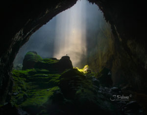 Son Doong, the world’s largest cave located in Vietnam and found by a local man named Ho Khanhin 1991, was recently discovered in 2009 by British cavers.
“Son Doong” was formed 25 million years ago by river water eroding away the limestone. Where the limestone was weak, the ceiling collapsed creating 2 gigantic skylights also known as dolines. The openings of the dolines are wide enough to fit two 747 planes side by side. These openings, have given life to the cave by allowing sun light to enter making it possible for two separate forests to grow within the cave. The main cavity is so enormous that it has its own climate, allowing clouds to form within it
The cave runs for approximately 9 kilometers (5.6 mi) and could fit a 40- story skyscraper within its walls. The cave contains some of the tallest known stalagmites in the world, which are up to 240 ft.
To this date, less than 900 people have been lucky enough to be inside Son Doong.
To reach Hang Son Doong, you must first pass the third largest cave in the world, Hang En Cave, which is just as impressive as Son Doong. Getting to Hang En Cave took us a full day, followed by another half day’s walk in the jungle, crossing many knee-deep rivers, to finally reach the entrance of Son Doong. I imagined the entrance being this very large opening. To my surprise, the main entrance of the cave was a small, very tight opening. Out of this small opening, we felt a cold draft of air and saw clouds rising into the surrounding forest. This is caused by the cooler air inside mixing with the hot air of the jungle. In no time we were descending 262 ft. (80m) down a steep wall, using harnesses and ropes and maneuvering on slippery ground in a gigantic dark cavity. It was there that I began to realize how incredible this expedition was going to be. I knew right then and there I had reached Son Doong.
Photographing the cave
The photography was a challenge in some respects. The lighting conditions were very difficult. There was quite a bit of daylight in the dolines (sinkholes), so the dynamic between light and dark was extreme, but our headlights helped as a light source in the depths of the cave. Additionally, to light the caves we used three 32,000 lumen LED spotlights, whose batteries could power them for approx. 15 minutes in total. On top of all that, the ground was wet and slippery, plus we were always searching for even ground to set the tripods.
Hand held radios were used to direct the position of the light and the models. At times from over a kilometer away, we coached them as to the perfect lighting and positions. The window of time to capture an image was very small. The constant mist inside the cave prevented us from being able to clearly see far. But, that mist added a mystical theme to the photos of this beautiful underworld.
I had two great cameras with me – the Nikon D800 was my primary camera and the D300 as a backup. The lens I used the most, the Nikon 28-300 mm, was attached to the D800. On the D300, I mostly used the 35mm f1.8 and the 14-24mm f2.8 lens I would use on my D800 at times. A stable tripod was just as important as the camera. With the Manfrotto 190 CXPRO3 carbon fiber and the Manfrotto 324RC2 light grip joystick tripod ball head, I had a very good, lightweight combo on hand.
It goes without saying, I had a plethora of memory cards and batteries in my bag. To further back up the files, I copied all images to an external hard drive (hyper drive).
I focused on reducing the number of lens changes to a minimum due to the high humidity, sand, and constant dripping in the caves (not to mention the sweat dripping from my forehead). So, another essential piece of equipment for me was a dry microfiber cloth and a clean bandana within reach. Lenses would continuously get foggy or dusty and sand would adhere to the legs of the tripod, making them difficult to extend.
Using a flash was pointless, due to the incredible scale of the cave. So, it was very important that I was familiarized with my camera inside out. I find it’s crucial that you’ve set up your menu and buttons in a way that makes sense so you can use it in the dark. The same applies to all accessories, such as tripods and remotes. When using more than one camera, the basic configurations should be the same.
The Serengeti
 Much of the Serengeti was known to outsiders as Maasailand. The Maasai are known as fierce warriors and live alongside most wild animals with an aversion to eating game and birds, subsisting exclusively on their cattle. Their strength and reputation kept the newly arrived Europeans from exploiting the animals and resources of most of their land. A rinderpest epidemic and drought during the 1890s greatly reduced the numbers of both Maasai and animal populations. The Tanzanian government later in the 20th century re-settled the Maasai around the Ngorongoro Crater. Poaching and the absence of fires, which had been the result of human activity, set the stage for the development of dense woodlands and thickets over the next 30–50 years. Tsetse fly populations now prevented any significant human settlement in the area.
By the mid-1970s, wildebeest and the Cape buffalo populations had recovered and were increasingly cropping the grass, reducing the amount of fuel available for fires. The reduced intensity of fires has allowed acacia to once again become established.
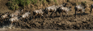
Each year around the same time, the circular great wildebeest migration begins in the Ngorongoro Conservation Area of the southern Serengeti in Tanzania and loops in a clockwise direction through the Serengeti National Park and north towards the Masai Mara reserve in Kenya. This migration is a natural phenomenon determined by the availability of grazing. The initial phase lasts from approximately January to March, when the calving season begins – a time when there is plenty of rain-ripened grass available for the 260,000 zebra that precede 1.7 million wildebeest and the following hundreds of thousands of other plains game, including around 470,000 gazelles.
Salinera de Maras
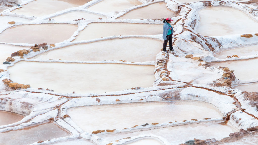 How do large amounts of salt deposits ended up in the middle of the Andes Mountains? Though the salt pans themselves are man-made, the water that is channeled through them comes from a subterranean natural spring, which is mixed with salt deposits from prehistoric salt lakes. Over millions of years, tectonic plate movement has buried the deposits deep beneath the mountains: the salt is accessible from an underground water flow of brine -a mixture of salt and water – that bubbles up in a natural spring near the small town of Maras.
Salineras de Maras, it’s believed that the salt pans were originally constructed by the Wari civilization, which predates the Inca. However, the Inca saw the economic opportunity in harvesting the salt of Maras and expanded the salt pans further up the mountainside. The salt is mined through the evaporation of the brine that is channeled into the pans. When the water evaporates, members of the local communities carefully scrape the salt crystals from the earthen surfaces. When all of the crystals are removed, the pan is filled with the salt water again – a process that has been practiced since before the time of the Inca.
Today there are over 6,000 salt pans near Maras, and each one is no more than 13 square feet and less than 1 foot deep. Each pan is owned and mined by a local family of the Maras community, and the salt is collected and sold in local shops or nearby towns.
Copan
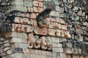 Copán is an archaeological site of the Maya civilization located in the Copán western Honduras, border with Guatemala. It was the capital city of a major Classic period kingdom from the 5th to 9th centuries AD. Copán was occupied for more than two thousand years, from the Early Preclassic period to the Postclassic. The city developed a distinctive sculptural style within the tradition of the lowland Maya, perhaps to emphasize the Maya ethnicity of the city’s rulers.
Little is known of the rulers of Copán before the founding of a new dynasty with its origins at Tikal in the early 5th century AD, although the city’s origins can be traced back to the Preclassic period. After this, Copán became one of the more powerful Maya city states and was a regional power in the southern Maya region.
The Hieroglyphic Stairway
This is the most famous of Copan’s monuments. The stairway contains 63 steps completely carved with hieroglyphs that tell the history of the royal house of Copan. It is the longest known text of ancient Mayan civilization. Archaeologists are still studying and deciphering the whole meaning of the hieroglyphic text.
The Tunnels
Located underneath the Acropolis are over 4km of tunnels with two of them open to the public: Rosalila that includes the remains of the temple with the same name and Los Jaguares, which travels through a system of aqueducts, tombs, and former baths. In the tunnels you can see earlier stages of Copan civilization.
The Amazon
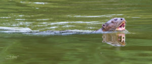 The Amazon is the greatest river in the world by so many measures; the volume of water it carries to the sea (approximately 20% of all the freshwater discharge into the oceans), the area of land that drains into it, and its length and width. It is one of the longest rivers in the world and, depending upon who you talk to, is anywhere between 6,259km/3,903mi and 6,712km/4,195mi long. Our group only explored a small portion of this great river but we were fortunate to encounter tribes that have been leaving there for years.
The length of the Amazon and the Nile Rivers have been in a close-fitting for title of world’s longest river. The Nile River in Africa is reported to be anywhere from at 5,499km/3,437mi to 6,690km/4,180mi long. But there is no question as to which of the two great rivers carries the greater volume of water – the Amazon River.
Most of our exploring was done in a small wooden boat equipped with an out-board engine in the back and a spare one in the front as a backup. In our boat, we carried our supplies for five days, two guides, a cook, and our camera gear. Every day we would move from one point to the next navigating this awesome river. When we would reach our destination, it is when our trekking by land began. Moving inside the jungle of the Amazon it’s no easy task, especially with mud up to your knees, temperatures in the low to mid 90’s, and 100% humidity. This was physically a daunting task. Staying hydrated was our number one priority.
The photography was a challenge in some respects. The lighting conditions were very difficult. There was quite a bit of daylight in the jungle but the shadows that were casted by the trees posed a challenge. On top of all that, the ground was wet and slippery, plus we were always searching for even ground to set our gear.
I focused on reducing the number of lens changes to a minimum due to the high humidity and constant dripping sweat from my forehead. So, another essential piece of equipment for me was a dry microfiber cloth and a clean bandana within reach. Lenses would continuously get foggy or dusty and sand would adhere to our gear.
Kilimanjaro
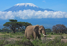 The Luse-O’Hara Foundation Kilimanjaro climb is to an initiative to help benefit the Ronald McDonald House. The climb will take place in September 2014 and I am privileged to be the official photographer that will document this event. The climb parallels the journey that a family experiences when their child faces a life-threatening illness. We climb to honor their fathers, live their mission, and help raise money for the children and families at the Ronald McDonald house of the Twin Cities. Click here to make your tax deductible donation.
Three degrees south of the equator and 19,341 feet above sea level lies a mountain like no other. Kilimanjaro; a place that is the epitome of intrigue. Kilimanjaro is the highest mountain in Africa and the highest free standing mountain in the world.
Canyons
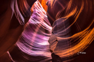 It’s hard to describe the beauty of slot canyons of the southwest – they are one of those things in nature that you really have to see it to believe it. These canyons have been formed over millions of years on the Colorado plateau as floods have cut its way through sandstone making narrow tall slots with beautifully sculpted walls. Colorado is blessed with a multitude of canyons but slot canyons consist of only sandstone- this leads to the creation of canyons which may be only a few feet wide but hundreds of feet high.
The best known of these slot canyons are, Upper and Lower Antelope Canyons near Page in Arizona. Photographically these canyons are the most appealing. Upper Antelope is the most visited, accessed easily, and once inside the canyon the floor is level and no climbing required. On the other hand, Lower Antelope Canyon is the deeper of the two and some climbing is involved.
Outside of these two well-known canyons there are others I have visited but they require some planning and effort on the part of the photographer. Before venturing to any canyon there are some safety considerations you should review. All slot canyons are prone to flash floods and if you are caught in a canyon during a flash flood the chances are that you will be unable to get out before it is too late. Floods can happen at any time of the year and thunderstorms are more common in the afternoon than the mornings. Even in the well visited Antelope Canyon a flash flood killed 11 tourists in 1997.
Be sure to carry all the water you need, a map, and a compass (landmarks may be few and far between), never travel alone, and always let someone know where you are going and when you intend to return. With these safety tips in mind, the best time to photograph slot canyons are around midday in summer months when the sun is high in the sky and the beauty of the canyons is revealed in the reflected light on the walls. Beams of light will find themselves coming into the canyons in the most unexpected places. These beams of light provide the colors to the stone formations and those colors are constantly changing.
Having a tripod is a must and be sure to pack and a wireless shutter release. A variety of focal lengths will produce pleasing results, all the way from wide angle to long telephoto – the key to successful compositions will be how you decide to approach the contrast that you will see. Whatever you do, do not change lenses inside the canyons. You will need two camera bodies to prevent you from getting dust inside the camera when changing lenses. Personally, I set my white balance to the cloud setting. My ISO fluctuated depending on the light available (100 to 400) and my aperture was between f/7 to f/10. I used a Nikon D800 and also a Nikon D300S. I used two different lenses, the Nikon 20 to 300mm and the Nikon wide angle 14 to 24mm f/2.8
Deep shadows can be a great framing tool in the slot canyons but just beware not to fill too much of your frame with them. Whatever you do, do not shoot directly at the canyon openings where the direct light is coming in.
Machu Picchu
Photographing Machu Picchu
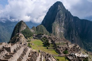
In late September, I will begin my journey to one of the most photographed places in the world. This journey will take me high through the Andes, the longest continental mountain range. The mountain range runs like a serrated spine down 4,300 miles of western South America, escalating to nearly 23,000 feet. The slopes around Machu Picchu are steep, full of stairs, and made over 800 years ago. We’ll spend three nights and four days trekking over 32 km and reaching a high point of 13,780 feet. We will approach our last day to Machu Picchu via the Sun Gate, high above the ridged stone walls built by the Incans. The photo ops during the hike will be breath taking and rich with culture.

